 I chose to take an adventure kayaking down the Rush River on September 12th. I really enjoy exploring places I’ve never been before, and I’ve never kayaked the Rush River. I didn’t know what to expect on my adventure, or how long it would take. The only way to explore this area of the Rush River is to kayak it because most of it is surrounded by private property. My kayak adventure turned out to be a success. I spent four-and-a-half hours of pure joy and relaxation floating and paddling through part of the beautiful Rush River Valley and ended at my destination in El Paso, Wisconsin.

Sights Along the Rush River

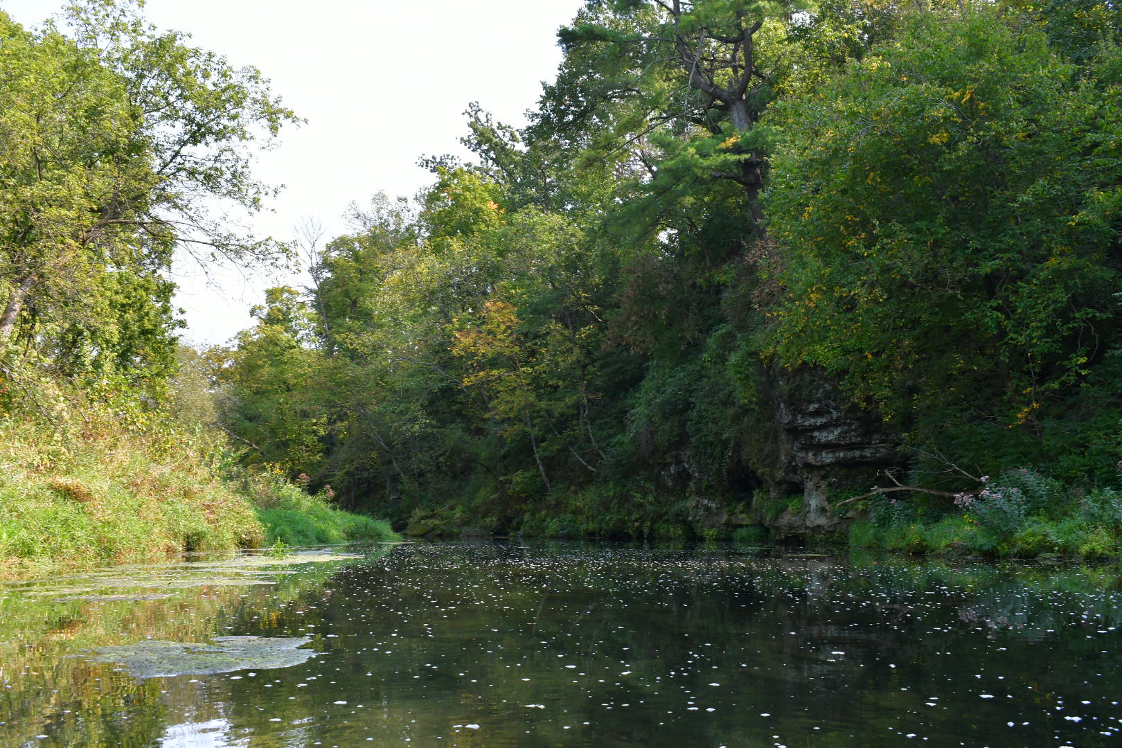
The Rush River flows through some beautiful countryside. As you travel down the Rush River you will see a variety of trees along the riverbanks, covering hillsides, or hanging off limestone cliff walls. Some of the limestone walls are over fifty feet high with holes in them, and some are even big enough for a person to climb into and explore. You will also notice different flowers and grasses covering the sides of the riverbank in places. What you won’t see are very many houses. You also won’t see a lot of litter. The Rush River is very clean, but occasionally you will see something that probably washed down during a time the river flooded and got hung up on a tree.

I chose to stop along the way and explore one of those caves I saw in the town of Martell. I climbed into it as far as it went into the limestone cliff. I don’t know if any of the other holes along the Rush River were big enough to fit a person inside, but I wouldn’t mind doing this part of the river again and checking them out.
Wildlife on the Rush River

There is plenty of wildlife to see along the way. At one point, I scared a deer from the tall grasses along the bank of the river. All I saw was its whitetail as it ran away. Dragon flies dove down, hit the water, and took off again. Swimming trout covered the bottom of the river in many places. Bugs flew just above the water causing fish to jump out of the water. One jumped right next to the kayak. Birds such as goldfinches, nuthatches, belted kingfishers, turkey vultures, and bald eagles were seen flying along the Rush River.

A great blue heron stayed with me most of the way down river on my adventure. As I got close to it, the heron would take off flying downriver. It would land again. As I got closer, it would take off again flying downriver. It was a vicious cycle. I wondered when he would learn to fly upriver instead of downriver.
Entry and exit points in the Rush River
Highway 29

The place that I entered the Rush River to kayak is on highway 29 on the southside of the road. There is a paved parking lot there that is about a mile from highway 63. This parking lot is in between the Wisconsin towns of Baldwin, River Falls, Spring Valley, and Ellsworth. There is a short path leading from the parking lot to the river with a slight decline. The area by the river is free from vegetation and easy to put your kayak into the water. The people who typically use this parking lot area go fly fishing and not kayaking.
Martell Highway 63


Martell, Wisconsin has another entrance or exit to the river on the north side of highway 63 right next to the bridge that goes over the Rush River. You will need to get out on the right side of the river before you go under the highway 63 bridge, if this is your exit point. At this location is a small park that people sometimes picnic in, but it’s mostly used by people going fly fishing. The grass is mowed up to the river in spots, so there isn’t a path you are getting out at. The riverbank here is a foot or two high in places, so you might have to climb up to get out. This park is right on highway 63 in Martel.
730th Avenue


Along the road is a little parking spot with a sign. Down the road a little bit is a bridge that goes over the river. The bridge is not a good place to put a kayak into or take one out of the river, but the small parking spot is a good place. It gradually goes into the water here and is very easy to get your kayak in and out of the river.
El Paso County Road N


The exit I used was the first bridge you get to in El Paso which is right where county road N comes into El Paso. I would not recommend this as an exit point. It is very weedy, steep, with no real path leading out. It is difficult to climb out of the river here. You would also be parking on the road because there isn’t a parking lot to access the river. The next bridge in El Paso looked better to climb out of the river, but you are still going to be parking along the road here.
570th Avenue and then Ellsworth Rod and Gun Club on Highway 72
There is another exit at the next bridge with a parking lot. I know people go tubbing from this point to the Ellsworth Rod and Gun Club which will be the next exit after this one. I did not Kayak this stretch of Rush River that goes from El Paso to 570th Avenue. I also have not kayaked from 570th to the Ellsworth Rod and Gun Club which is on Highway 72. This is going to be the next section of the river I will kayak, but I might have to wait until next summer to try it. Eventually the Rush River will enter the Mississippi down by Maiden Rock in the Rush River Delta State Natural Area. I don’t know if you can kayak the whole thing.
Description of the Rush River


The Rush River ranges in depth from a couple inches to about 4 feet deep. It typically is about one to two feet deep with a rocky bottom normally. The water on the Rush is very clear. I could always see the bottom of the river. This also allowed me to see large limestone rocks in the water that I needed to go around or risk getting hung up on them. The beginning of my trip had very few stretches of rapids. The second half of the trip got more excited with a lot more rapids. The Rush River also had lots of plants in it, and sometimes the plants ended up as thick mats on top of the water. It is important to avoid these because you will get stuck in them. They also typically have a large rock at the beginning of them.
Time between sections on Rush River
The current in the Rush River seems slower than the Kinnickinnic River. This could also be due to less precipitation in recent days when I went. I didn’t have to worry about getting flipped by the current after getting hung up on rocks and turning sideways.
- From Highway 29 to the first bridge in Martell, which is Highway 63, it takes a little less than an hour.
- From the first bridge in Martell, Highway 63, to the last bridge in Martell, 780th Avenue, it takes about 20 minutes. There are 3 bridges in total to go under.
- From the last bridge in Martell, 780th Avenue, to the next bridge, 730th Avenue, it takes about 40 minutes.
- From that bridge, 730th Avenue, to an exit point that is not a bridge it takes about 15 minutes.
- From that exit point, which is on the left side of the river, to the next bridge, 690th Avenue, it takes an hour.
- From that bridge, 690th Avenue, to the first one in El Paso, County Road N, it takes about an hour and 15 minutes.
The total time to kayak the Rush River from highway 29 to El Paso is about 4 hours and 20 minutes.
Problems you might face
- No cell service at times
- No bathrooms anywhere along the way
- Shallow in places
- Rocks to get hung up on
- Mats of seaweed to get stuck on
Please check out my other posts that tell you a little more about kayaking safety.


Leave a Reply